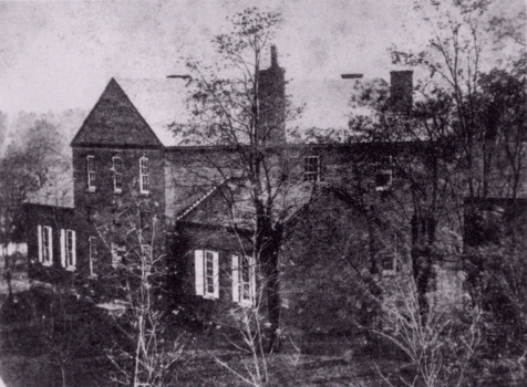
Charles Brewer Collection, Peerless Rockville
Then and Now
Civil War Era Places in Town
The following are images that date from about the Civil War period,
paired with modern pictures of the same view.
 Charles Brewer Collection, Peerless Rockville |
Then: This is the earliest picture (c. 1870) of the Montgomery County courthouse in Rockville. This is the building that stood during the Civil War. In front, Courthouse Square was a common gathering place for the public. Both impromptu and organized debates occurred here over public issues of the day. In the run up to war, the main debate was whether Maryland should secede from the Union and join the Confederacy, or not. The courthouse was used as a hospital at several times during the Civil War. |
| Now: [2006] While approximately the same view pictured above and more obstructed by modern trees, this is not the same courthouse building. The Red Brick Courthouse on the site today dates from 1891. |
|
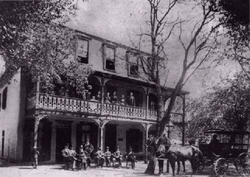 Courtesy of Frances Robey Barnes, Rockville, Portrait of a City, p. 54 |
Then: Across Courthouse Square, the Montgomery House was the largest hotel in Rockville in the 1860s. General McCausland and his staff spent the night here on July 10th, 1864. They paid their bill the next morning in Confederate money. General Early sat on the porch most of the morning of July 13th, while his army retreated through town. He wrote orders, studied maps, smoked a cigar and contemplated his circumstances. Later, Colonel Lowell also sat on the porch and was writing a field report when Confederate cavalry counter-charged into town during the Battle of Rockville. He commented on the interruption and his hastily forming a firing line in the street to confront the charge. |
| Now: [2006] The Montgomery House no longer stands. Its site is now the NW corner of Maryland Avenue and Courthouse Square and is occupied by this modern office building. This is approximately the same view as above. |
|
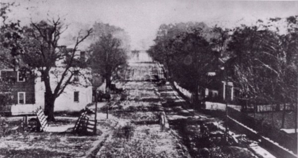 Charles Brewer Collection, Peerless Rockville |
Then: This is the oldest known photograph of Rockville's main street. It can be dated circa 1872 by the presence of the hay scale to the left, located in the triangular public space in Courthouse Square. The main street is Montgomery Avenue stretching toward the ESE. The courthouse is just out of the image to the right (steps to the entrance visible, lower right). Off in the distance and up the grade is the junction of Montgomery Avenue and the Rockville Pike, near St. Mary's Church. |
| Now: [2006] The old perspective above no longer exists, the main commercial streets were significantly changed during the urban renewal in the 1060s and 1970s. This is about the same view today, as above. If it still existed today, the original Montgomery Avenue would proceed past the fountain and through the Judicial Center, County Executive Office building, Monroe Park, the Americana Centre to connect with the Rockville Pike at the "mixing bowl" intersection. Monroe Park is the last open space vestige of Rockville's historic main street. |
|
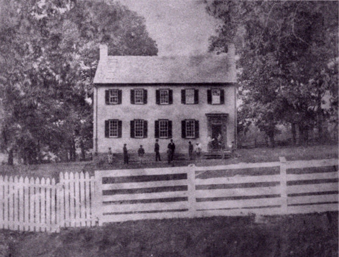 Charles Brewer Collection, Peerless Rockville |
Then: The Rockville Academy [circa 1880] as seen from Jefferson Street. This was the original white frame building. The school was founded in 1805 with money raised in a lottery, chartered in 1810, and open for its first classes in 1812. It received some public funding (from the Maryland General Assembly) from 1811 to 1916 to support students who could not otherwise afford the private tuition. |
| Now: [2006] The Rockville Academy building today, also viewed from Jefferson Street. The original school was replaced by this brick structure., which was reoriented to face South Adams Street (the porch over the main door is visible at left). |
|
|
|
Then: Beall Dawson House (circa 1870). Note the raised front porch and the Beall sisters seated upon it. |
| Now: [2006] Beall-Dawson House today. It is owned by the City of Rockville, with the Montgomery County Historical Society operating programs here that are open to the public. |
|
|
|
Then: Christ Episcopal Church. At this church in 1863, JEB Stuart arrested a number of Rockville residents supporting the Union cause. |
| Now: [2006] Christ Episcopal Church as it appears today. Note, the church was badly damaged in the hurricane of September 29, 1896, when the upper steeple toppled, windows were broken and the facade damaged. Through the years, the gable and entryway were changed and a parish hall added. |
|
|
|
Then: St. Mary's Catholic Church [photo circa 1896]. This is the oldest church building in Rockville, with the first mass held in 1817. Then, the building overlooked the intersection of roads to Bladensburg and Georgetown. At this intersection, Jubal Early split his cavalry force from the main body of infantry in his 1864 raid. The main body marched to Silver Spring and battle at Fort Stevens. The cavalry travelled the Rockville Pike to the area of Fort Reno and inconclusive action. The forces rejoined in Rockville on the retreat two days later. |
| Now: [2006] Today the church shares its lot with a larger, modern main sanctuary. The chapel functions for daily mass and as a popular wedding venue. Author F. Scott Fitzgerald and members of his family are buried in the cemetery alongside. Today, the church overlooks the same intersection of roads now called Veirs Mill Road and Rockville Pike. With the 1950s addition of Hungerford Drive as a bypass to Rockville's commercial street, this is a busy intersection. It is arguably the symbolic cross-road for the county, and locals refer to it as "the mixing bowl" for its unconventional configuration and heavy volume of traffic. |
|
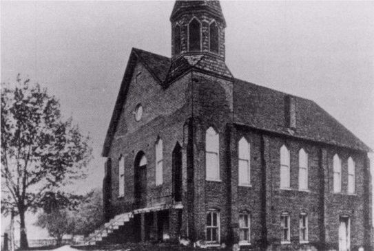 Peerless Rockville |
Then: A Methodist Episcopal (M.E.) Church has been located on Wood Lane since the 1830s. Prior to the Civil War, Methodist congregations around the country divided over whether slave-holding was proper. In Rockville after the war, white Methodists formed the M.E. Church South and constructed a new church building on Montgomery Avenue. Black Methodists took title to the original building, rebuilt it on the Wood Lane site in 1892, and renamed it Jerusalem M.E. Church. This photo shows Jerusalem Church in 1906. |
| Now: [2006] Jerusalem-Mt. Pleasant United Methodist Church, as it appears today. In the 1950s, the steeple and outside steps were modified and the church was covered with stucco. |
|
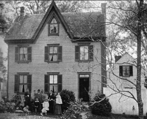 photo courtesy of Mary Dawson Gray |
Then: The Rocky Glen farm house, (photo circa 1894) with the Dawson family and visitors arrayed in front. The main portion of the house shown here was a 1874 addition. The ealier portion of the house is the smaller white structure in the background, to the right. Lawrence Dawson, whose family lived here during the war, was among Unionists arrested at Christ Church during JEB Stuart's visit to Rockville in 1863. |
| Now: [2006] The Civil War era portion of the Rocky Glen farm house no longer exists. But the 1874 Gothic Revival portion (pictured here) remains off Ritchie Parkway, adjoining Dawson Farm Park. Peerless Rockville saved this house from destruction, acquiring it in a bad state of decay and "homesteading" it to a family that restored it and continues to reside there. |
|
© 2006, Peerless Rockville, Historic Preservation Ltd.